


Key takeaways
- El Niño 2026 has already broken daily ocean-temperature records, topping 30°C in the key Niño 3.4 region for the first time ever measured.
- On October 8, NOAA gave an 83% chance this event beats every El Niño since 1950 — about two months before the usual December peak.
- The heat comes from a huge reservoir of warm water below the surface, built up over months and now spilling east across the Pacific.
- Scientists watch it with buoys, satellites and a family of indices — and the “official” record uses three-month averages, not daily spikes.
- The biggest effects usually arrive the year after the peak, which is why experts expect 2027 to be exceptionally hot.
El Niño 2026 is rewriting the record books before it has even peaked. On October 5, the daily sea-surface temperature in the Niño 3.4 region — the patch of the central Pacific that scientists use as their main thermometer — hit 30.06°C, the first reading above 30°C ever recorded there. Three days later, NOAA’s Climate Prediction Center said there is now an 83% chance that the October–December season will beat every El Niño since 1950. Here is what El Niño is, why this one is so strong, and what to watch this winter.
What El Niño is, and why it shifts the weather
El Niño is the warm phase of the El Niño–Southern Oscillation (ENSO), a natural back-and-forth between warm and cool states of the tropical Pacific. Most of the time, steady easterly trade winds push warm surface water toward Asia and Australia. That piles warm water up in the west and lets cold, nutrient-rich water rise from the depths along the coast of Peru and Ecuador — a process called upwelling.
Every few years, the trade winds weaken. The warm pool sloshes back east toward the Americas, the east–west temperature contrast flattens, and upwelling shuts down. The atmosphere responds in a giant loop called the Walker circulation, which weakens and reinforces the ocean change. NOAA calls it an El Niño when the Niño 3.4 box (5°N–5°S, 120°W–170°W) stays at least 0.5°C warmer than average, with the atmosphere joining in.
Because the tropical Pacific is Earth’s largest heat engine, flipping its state rearranges rainfall, drought and storms across the planet.
Why El Niño 2026 is breaking records
The numbers this year are striking, and they arrived early — roughly two months before El Niño typically peaks in December.
On October 5, 2026, the daily average sea-surface temperature in the Niño 3.4 region reached 30.06°C, according to NOAA’s OISST data via Climate Reanalyzer. That was the first time the daily reading topped 30°C on record; the previous high was 29.82°C on November 17, 2015. The reading sat about 3.4°C above the early-October average.
Two weeks earlier, around September 21, the daily anomaly — the departure from normal — had already beaten the old daily record from November 2015, at roughly +3.0 to +3.1°C. Different analyses disagree on the last decimal place, which is normal for preliminary satellite blends; the direction is unambiguous.
September’s monthly figures from NOAA’s October 8 discussion tell the same story: Niño 3.4 was +2.1°C, Niño 3 was +3.0°C and Niño 1+2, off Peru, was +3.9°C. In parts of the eastern equatorial Pacific, anomalies topped +4.0°C. Below the surface, a vast reservoir of warm water sat more than 10°C above average at depth.
Then came the forecast. NOAA’s Climate Prediction Center put the chance that the October–December season beats every El Niño since 1950 at 83%, up from 75% a month earlier — the threshold is +2.5°C on the three-month Relative Oceanic Niño Index. The World Meteorological Organization, drawing on 13 modelling centres, said on the same day that the event is nearly certain to persist through February 2027 and could be one of the strongest since at least 1950, with the October–December seasonal average forecast near +3.7°C — far above the previous record of +2.6°C (November 2015 to January 2016). Model forecasts put the possible December peak between +3.9 and +4.3°C.

The daily average temperature in the Nino 3.4 region hit 30.06C on October 5, 2026 – the first reading above 30C on record. Image generated by AI.
How scientists actually measure it
No single thermometer captures El Niño. A network of moored buoys across the equatorial Pacific — the TAO/TRITON array — measures water temperature at and below the surface. Satellites add the wide view: infrared sensors map sea-surface temperature daily, and altimeters measure sea level, because warm water expands. NASA’s Sentinel-6 Michael Freilich satellite spotted the early signal in March to May 2026, when a warm wave called a Kelvin wave crossed the Pacific; by mid-May the sea around Peru stood more than 15 centimetres higher than average, a sign of the heat arriving.
All that data feeds indices. The Niño 3.4 number is the raw temperature in the key region. The Oceanic Niño Index (ONI) averages three months. The Relative Oceanic Niño Index (RONI) goes a step further and subtracts the warming of the whole tropical ocean, so a generally warmer world does not inflate El Niño’s score. That is why the “official” rankings use the three-month RONI — a daily spike, however dramatic, is not the official record.
What a super El Niño usually does to the planet
A strong El Niño shifts the planet’s rainfall map. Winters in the southern United States often turn wetter, while Australia, Indonesia and southern Africa tend drier. Droughts and floods show up in unusual places, Atlantic hurricanes are usually suppressed while Pacific ones get a boost, and the year after the peak is often the hottest on record — which is why experts already expect 2027 to be exceptionally hot. September 2026 was the second-hottest September on record globally, and the global average sea-surface temperature hit a September record of 21.05°C, 1.63°C above preindustrial levels.
Some effects are already being reported: drought hitting crops and livestock in Central America, limits on Panama Canal traffic from low water, and fires in Indonesia. But NOAA’s forecasters attach a caveat that matters: with an event this large the chances of El Niño-type impacts are larger, though not guaranteed. An El Niño loads the dice; it does not write the script.
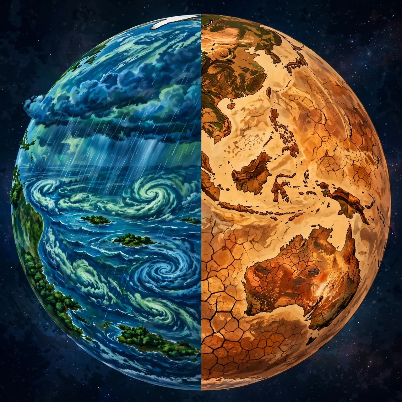
El Nino shifts global rainfall: wetter conditions over parts of the Americas and the central Pacific, drier weather over Australia, Indonesia and southern Africa. Image generated by AI.
Peru’s penguins feel it first
At Punta San Juan on the Peruvian coast lives one of the largest colonies of Humboldt penguins. When warm water shuts down upwelling, the cold Humboldt Current weakens, anchovies — the penguins’ main food — crash, and the birds starve or abandon their nests. Science News reported in October that the colony is on the brink and that a “super” El Niño could make it worse; another report, citing Science News, says the colony has lost 80% of its birds.
Penguins have survived strong El Niños before — colonies bounced back after the giant 1997–98 event — but each warm shock takes its toll on a species already pressured by overfishing and disease.
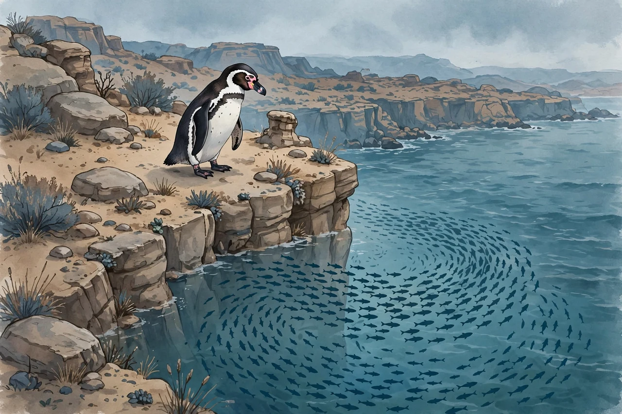
Warm water suppresses the upwelling that feeds anchovies, the Humboldt penguins’ main food. Image generated by AI.
What to watch this winter
The peak is most likely in December. NOAA’s next ENSO discussion lands on November 12, and forecasters will be watching whether the atmosphere fully couples with the ocean — the final ingredient of a historic event. One more thing to know: the ocean warms first and the atmosphere responds months later, so most of the global-temperature contribution from this El Niño will materialise in 2027. How hot that year gets, and whether the Northern Hemisphere winter delivers the classic El Niño pattern of storms and droughts, are the questions to track.
Why it matters
El Niño is not new — it swings every two to seven years — but the 2026 version is arriving bigger, earlier and hotter than any in the modern record. Understanding what it is, and what it is not, is how you read the winter ahead: not as random weather, but as the predictable exhale of the largest climate engine on Earth.
Related reading
El Niño stresses the oceans that marine life depends on. See what actually works to protect the world’s oceans, on the conservation measures with real results behind them.
Frequently asked questions
Will El Niño 2026 be the strongest ever?
It could be. NOAA gives an 83% chance the October–December season beats every El Niño since 1950 on the three-month RONI measure, and the World Meteorological Organization calls it a candidate for one of the strongest since at least 1950. The peak is expected in December, so the verdict comes this winter.
What is the difference between ONI and RONI?
The Oceanic Niño Index (ONI) is a three-month average of the temperature anomaly in the Niño 3.4 region. The Relative ONI (RONI) subtracts the average warming of the whole tropical ocean, so it measures how warm the Pacific is relative to the tropics rather than in absolute terms.
Is climate change causing this El Niño?
Scientists have not settled that question. El Niño is a natural oscillation, and its extremes are hard to attribute to human-caused warming. What is clear is that it is happening against the warmest ocean baseline ever measured — as WMO’s secretary-general put it, El Niño does not add heat to the system, it releases heat stored in the ocean, and this ocean is the warmest on record.
When will El Niño 2026 end?
The World Meteorological Organization expects it to persist through February 2027 with near certainty, fading after that. Its biggest effects on global temperature typically arrive the year after the peak, which points to a very hot 2027.
Sources
- NOAA Climate Prediction Center: ENSO Diagnostic Discussion, October 8, 2026 (public domain)
- NOAA Climate.gov: El Niño & La Niña explainer (public domain)
- NASA JPL: International Sea Level Satellite Observes El Niño Precursor (public domain)
- NASA Earthdata: Warmer Sea Surface Temperatures in the Eastern Tropical Pacific (public domain)
- WMO seasonal climate update reported via Phys.org, October 8, 2026
- YourWeather.co.uk: Pacific breaks historic 30°C record, October 5, 2026
- Weatherzone: Central Pacific exceeds 30°C for the first time on record
- YourWeather.co.uk: El Niño reaches a level never seen this early in the year
- AFP via Phys.org: El Niño sets temperature record in key Pacific zone, October 12, 2026
- Science News: Peru’s penguins are on the brink. A super El Niño could make it worse.
- YourWeather.co.uk: Humboldt penguins in danger as super El Niño threatens
- Particle News: El Niño ties daily record as models forecast unprecedented peak










0 Comments